Looking Down from Space
No classes today. Supposedly because of a typhoon. Not the SONA, mind you, but typhoon Glenda, which is supposed to dump heavy rains on us. But Glenda must have looked down favorably on us because not much rain came. With the unexpected free time at my disposal, I got to find out what the clouds see when they "look down" in the area where I live. I mean I got to use Google Earth and tracked our house, flying from space to our neighborhood. Here's our house amidst the open spaces and structures of Bayan Luma, Imus, Cavite (click on the image for a larger view).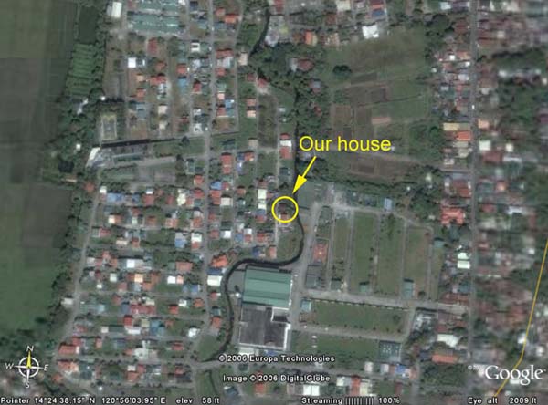
Zooming in, I got to see my immediate neighborhood, our house, and even the mango tree in the backyard. Of course, it helps that you have a sense of where things are. The view from the top is quite different from what we see on the ground.

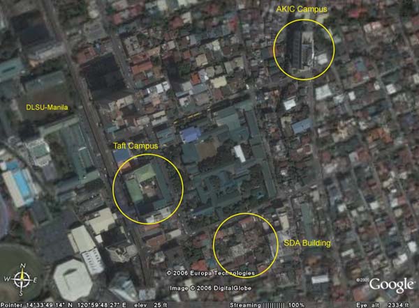
Racing towards Manila, I got to locate our place of work and made out the location of our three campuses.
These vistas reminded me of the first time I got to ride an airplane. Seeing the view from the airplane window, I got teary-eyed after having been reminded how insignificant we humans are amidst everything on the ground. And rather than being liberating, the experience guaranteed that my feet will always be planted firmly on the ground.
Google Earth is a free software which combines satellite imagery, maps and the power of Google Search to put the world's geographic information at your fingertips. It works on Windows and Linux, but you need a broadband connection and a 3D-capable graphics card to run it.
This application could be very useful in certain subjects like BIBSTUD (hovering over Israel and Egypt), HISTORY (visiting historical places), TOURISM (looking down on tourist spots), etc.
posted by Adi @ 2:38 PM
![]()

1 Comments:
Spoke too soon re rains. There is a heavy downpour in the afternoon in our area, about the same time as the start of the SONA :-)
Post a Comment
Subscribe to Post Comments [Atom]
<< Home